Monumental stone construction examined within the museum’s Post-Flood collection context.
A Message from the Curator
The Builders of a New World
After the Flood, Scripture describes humanity spreading outward once again, families becoming peoples, and peoples establishing themselves across new lands. Then, across the ancient world, something remarkable appears in the archaeological landscape. Human beings began building on an extraordinary scale. They quarried immense stones, transported them across difficult terrain, raised enormous walls and platforms, constructed cities upon mountains and islands, and fitted blocks together with a precision that still commands attention today. At some sites the individual stones are astonishing. At others, it is the sheer size and complexity of the entire construction that leaves the visitor wondering how such ambitious projects were first imagined.
These places fill me with admiration for the people who built them. Imagine arriving at an untouched landscape and seeing not what was there, but what could be there. A wall. A temple. A fortress. A city. An island complex rising from the water. Before the first stone could ever be moved, someone had to envision the finished structure and understand how thousands of individual tasks could bring it into existence. The surviving ruins allow us to glimpse a world of engineers, stoneworkers, planners, laborers, sailors, rulers, and craftsmen whose knowledge was written not on paper, but into the landscape itself. The deeper we look at what they accomplished, the greater the mystery becomes: Who were these remarkable builders, what knowledge did they possess, and how much of their story have we yet to rediscover?
David PinterCurator, Archoseum
EXPLORE THE COLLECTION
Post-Flood Megalithic Engineering
Open an exhibit below to investigate monumental construction, stoneworking, transport, engineering methods, archaeological evidence, and the questions these structures continue to raise.
◆
01Exhibit 01Nan MadolPohnpei, Micronesia
Nan Madol
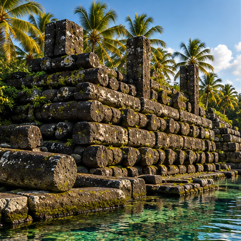
Built across a reef flat beside Temwen Island, Nan Madol is a monumental complex of more than 100 artificial and modified islets separated by tidal canals. Its surviving architecture combines coral fill, basalt boulders and naturally formed columnar basalt. The physical record demonstrates remarkable planning and organized labor. The exact methods used to transport and place the largest stones are only partly recoverable from archaeology.
Nan Madol engineering plate. The illustration emphasizes the relationship between columnar basalt masonry, water access, scale and artificial-islet construction. Measurements shown in the artwork are visual aids and should be read with the evidence qualifications below.
Physical Record
What survives at the site and can be directly observed.
Measured Evidence
Dating, dimensions, sourcing and archaeological measurements.
Engineering Inference
Reconstructions consistent with the evidence, but not directly witnessed.
Oral Tradition
Pohnpeian accounts preserved separately from archaeological demonstration.
Unresolved Questions
Questions for which present evidence does not establish a single answer.
Site form100+ islets
Core areaAbout 83 hectares
Direct monument datingAbout AD 1180 to 1200
Nandauwas wallsAbout 25 ft high
Largest stonesTens of tons
Physical Record
Nan Madol occupies a reef and lagoon setting off the southeast coast of Pohnpei. More than 100 constructed islets contain the remains of palaces, temples, mortuary areas and residential domains. Basalt and coral retaining walls hold large quantities of rubble fill above the reef surface. Waterways between the islets function as tidal canals and make the relationship between architecture and water impossible to separate.
Construction pattern: Many walls use prismatic basalt columns laid in alternating orientations. Long stones form horizontal courses, while other columns cross or lock the wall mass. Coral boulders and rubble fill the interior of constructed platforms. No mortar was required to create the principal basalt wall faces.
Measured Evidence
Evidence
What it supports
Important qualification
More than 100 artificial and modified islets
A deliberately engineered ceremonial and political landscape built across reef and lagoon.
Published counts vary because researchers define the core, peripheral islets and individual architectural units differently.
Approximately 83 hectares of monumental core
Construction took place on a city-scale landscape rather than at a single temple or tomb.
The wider archaeological district is much larger than the monumental core.
Basalt geochemical sourcing
Architectural stone came from several geological sources on Pohnpei. Work at Nandauwas linked important stones to Pwisehn Malek, across the island from Nan Madol.
Geochemistry can identify a likely source area. It cannot reveal the exact vessel, route, rigging or labor sequence used for each stone.
Uranium-thorium dating of construction coral
High-precision dates from coral associated with the elite mortuary complex at Nandauwas provide direct evidence for monumental construction around AD 1180 to 1200.
The dates apply to sampled construction contexts. They do not assign one absolute construction year to the whole site.
Monumental basalt blocks and columns
The engineering system handled stones ranging from manageable pieces to blocks weighing many tons. The U.S. National Park Service reports the heaviest basalt pillars at about 100,000 pounds, roughly 50 tons.
Published weights are not measurements of every block. Weight estimates for individual stones should not be generalized to the entire complex.
Nandauwas enclosure
The principal mortuary enclosure preserves walls approximately 25 feet high and some of Nan Madol's most imposing masonry.
Surviving wall height is not necessarily identical to original height at every point.
Construction Chronology
Nan Madol did not appear in a single building event. Archaeological work indicates earlier occupation and construction in the area, followed by increasingly monumental architecture. UNESCO broadly places the surviving palaces, temples, tombs and residential domains within approximately AD 1200 to 1500. A separate high-precision study of construction coral at Nandauwas places the beginning of monumental building there around AD 1180 to 1200. These ranges are compatible, but they answer different questions.
Dating evidence: The AD 1180 to 1200 estimate comes from uranium-thorium dating of coral used in a specific monumental construction context, combined with archaeological interpretation and stone sourcing. The broader AD 1200 to 1500 range describes the principal period represented by the World Heritage property. Neither should be presented as an exact date for every islet or wall.
Quarry Sources and Stone Movement
Pohnpei contains natural exposures of columnar basalt created by volcanic cooling. Geochemical studies show that Nan Madol's builders did not rely on a single convenient source beside the site. Stone was drawn from multiple places on Pohnpei, and material used at Nandauwas has been traced to Pwisehn Malek on the opposite side of the island. This is one of the strongest pieces of evidence for substantial logistical organization because the geological origin of the stone can be compared directly with its final architectural location.
Established fact versus inference: The movement of stone from source areas on Pohnpei to Nan Madol is supported by geochemical matching. How the stones completed that journey is inferred. Water transport is plausible in an island environment dominated by coastlines and canals, but archaeology has not recovered a complete Nan Madol transport system.
Engineering Reconstruction
Transportation by Water
One of the most practical ways to approach the transport problem is from the water. Nan Madol stands in a lagoon environment, its artificial islets are separated by tidal canals, and at least some architectural basalt came from distant parts of Pohnpei. Those facts make some form of water-assisted movement a reasonable engineering possibility. A heavy column could have been brought to the coast, supported by a raft or other buoyant platform, towed or paddled along the shoreline, and then maneuvered through shallow water toward a construction landing point.
That reconstruction remains incomplete. No surviving Nan Madol vessel, raft, rope system or loading frame has been recovered that demonstrates exactly how the heaviest stones were carried. Canoes, lashed rafts, paired craft, flotation devices, towing systems and combinations of land and water movement can all be discussed as possible solutions, but the physical record does not presently identify one of them as the method. The regional routes shown in the illustration below are therefore exploratory. They visualize what island-to-island rafting would require, but they are not established quarry routes. Current geochemical evidence points to Pohnpei itself as the demonstrated source of sampled architectural basalt.
Engineering reconstruction, not a mapped ancient route. This illustration explores how rafting or other waterborne transport could have moved heavy stone through the Micronesian island environment. Routes from islands beyond Pohnpei are hypothetical visualizations. Geochemical sourcing of sampled Nan Madol basalt demonstrates sources on Pohnpei, including material associated with Pwisehn Malek.
What the water hypothesis explains well: Water reduces the need to drag enormous stones across mountainous interior terrain, provides access around Pohnpei's coast, and fits a construction landscape built around channels and tidal waterways. What it does not yet explain: the exact flotation capacity, loading procedure, stability of the heaviest stones, towing arrangement, landing method and transfer from water to the upper wall courses.
Landscape Hypothesis
Could a Lower Sea Level Change the Problem?
A very different possibility can be tested as a landscape thought experiment. If sea level were substantially lower, more reef and coastal ground would be exposed, channels would be narrower or absent, and some distances now crossed by water could become dry or shallow terrain. Under such conditions, builders might rely more heavily on sledges, rollers, prepared tracks, levers and short overland hauls rather than rafts.
The chronology is crucial. The directly dated monumental construction at Nandauwas falls around AD 1180 to 1200, and UNESCO places the principal surviving monumental complex broadly within AD 1200 to 1500. The extreme low sea levels associated with the last Ice Age belong to a vastly earlier period. Present archaeological evidence therefore does not show that the known monumental city was built on a broad dry-land plain and later drowned by a major rise in sea level. Nan Madol is instead documented as a complex of artificial islets constructed with basalt and coral on a reef and lagoon setting.
Landscape hypothesis and thought experiment. This illustration asks how a substantially lower sea level would change the engineering problem by exposing more land and reducing water crossings. It is not presented as a reconstruction of the archaeologically dated AD 1180 to 1500 monumental landscape, and it does not establish that Nan Madol was originally built on dry land.
What would have to be discovered? For a dry-land construction model to move beyond speculation, archaeologists would need evidence for older buried architecture, quarry or transport surfaces now below water, construction deposits predating the known monumental phase, or other securely dated features demonstrating that substantial Nan Madol building occurred under a different shoreline regime. Until such evidence is found, the lower-sea-level model remains an unresolved hypothesis rather than an alternative established history.
Artificial Islets, Canals and Seawalls
The engineering problem at Nan Madol was larger than stacking basalt. Builders created stable platforms on reef flats by enclosing areas with stone retaining walls and packing their interiors with coral and stone fill. The resulting islets were separated by tidal waterways. These canals provided access between architectural compounds and gave Nan Madol its distinctive water-defined plan.
Artificial Islets
Building Ground Where There Was Reef
The retaining walls created boundaries capable of holding enormous quantities of fill above and around the natural coral reef. The platforms then supported residential, ceremonial and mortuary architecture.
Water System
Canals as Infrastructure
The canals were not decorative gaps. They formed transportation corridors within the complex and connected built space directly to the surrounding lagoon.
Engineering Inference
The surviving site shows what the builders accomplished, but not every temporary device used while construction was underway. Researchers can infer likely methods from geology, shoreline access, traditional watercraft, stone mechanics and the finished masonry, yet those reconstructions remain different from direct evidence.
EstablishedLong-distance stone movement
Geochemical signatures connect architectural basalt with sources elsewhere on Pohnpei.
EstablishedWater-integrated construction
Artificial islets and tidal canals physically connect the architecture to the lagoon.
Reasonable inferenceTransport by water
Rafts, canoes or other marine transport have been proposed because of quarry locations and the coastal setting, but exact craft and rigging remain unknown.
UnresolvedFinal placement
The precise combination of ramps, leverage, cribbing, labor and lifting used to set the heaviest upper stones has not been demonstrated.
Nandauwas: The Engineering Test Case
Nandauwas, also written Nan Douwas, is the great mortuary enclosure and one of the most useful places for separating observation from reconstruction. Its massive basalt walls survive to roughly 25 feet in height. The central tomb complex has also produced directly dated construction coral, while geochemical analysis links architectural basalt to distant source areas. Here, monument scale, chronology and stone movement can be examined together rather than treated as isolated claims.
What Nandauwas demonstrates: By around AD 1200, Pohnpei supported the authority, labor coordination and transport network necessary to move large quantities of basalt and coral into a highly organized monumental complex. What survives does not tell us the complete sequence of loading, rafting, unloading and lifting.
Orientation and Landscape Alignment
Nan Madol's plan responds strongly to the reef edge, lagoon and shoreline rather than forming a simple cardinal street grid. A general southwest-to-northeast tendency has been described for parts of the monumental complex. That orientation is observable as a landscape pattern, but its purpose is not securely established. Topography, water circulation, access routes and construction on the reef are all reasonable considerations. A specific solar, lunar or stellar alignment should therefore be labeled proposed unless supported by site-specific measurements and archaeological evidence.
Pohnpeian Oral Tradition
Pohnpeian oral tradition attributes the founding of Nan Madol to the brothers Olisihpa and Olosohpa. Accounts describe them arriving by canoe from an outside place and possessing sacred or supernatural power. In traditional narratives, extraordinary means are sometimes used to explain the movement of the immense stones. After Olisihpa's death, Olosohpa is remembered as becoming the first Saudeleur ruler. Later traditions recount the overthrow of the Saudeleur order by Isokelekel.
Oral tradition, not measured archaeology: The names, journeys, sacred powers and supernatural construction episodes belong to Pohnpeian traditional history. They are preserved here because they are part of Nan Madol's cultural record. Archaeology can compare broad themes such as political centralization, outside connections and construction chronology, but it cannot verify supernatural stone movement.
What Archaeologists Know, Infer and Still Debate
Status
Statement
Why it belongs here
Established
Nan Madol was constructed from basalt, coral and fill on a reef and lagoon setting.
The architecture and materials survive and are directly observable.
Established
Stone was transported from more than one geological source on Pohnpei.
Geochemical sourcing links architecture to distant basalt exposures.
Measured
Monumental construction at Nandauwas was underway around AD 1180 to 1200.
Uranium-thorium dating provides direct chronological evidence from construction coral.
Interpretation
The scale of the site reflects centralized authority and organized labor.
This is a strong archaeological interpretation based on monument scale, elite architecture and settlement organization.
Inference
At least some heavy stone probably traveled by water.
Water transport fits the quarry geography and lagoon setting, but the exact system is not preserved.
Oral tradition
Olisihpa and Olosohpa founded Nan Madol using sacred or supernatural power.
This is a Pohnpeian traditional account, not a claim established through excavation or measurement.
Unresolved
The exact method used to position the largest stones in high wall courses.
Temporary ramps, lifting structures and rigging have not survived in a form that establishes one method.
Unresolved Questions
How were the heaviest basalt columns loaded and transported? Geological sourcing demonstrates movement over substantial distances. It does not preserve the complete transport technology.
How were stones raised and locked into the highest courses? The finished walls survive, but the temporary construction works do not.
How were labor and food supplies organized? Monument scale strongly implies coordinated labor and provisioning. Exact workforce size, work seasons and administrative mechanisms remain reconstructed indirectly.
How much did tides shape construction? The site is inseparable from its lagoon environment, but the detailed sequence by which builders exploited tides, channels and landing points is not fully known.
How should archaeology and oral tradition be compared? Both preserve information about Nan Madol's extraordinary political and sacred importance, but they are different categories of evidence and should remain visibly labeled as such.
Research Sources
UNESCO World Heritage Centre, Nan Madol: Ceremonial Centre of Eastern Micronesia, World Heritage listing and nomination documentation.
McCoy, M. D., Alderson, H. A., Hemi, R., Cheng, H. and Edwards, R. L. (2016), Earliest direct evidence of monument building at the archaeological site of Nan Madol (Pohnpei, Micronesia) identified using 230Th/U coral dating and geochemical sourcing of megalithic architectural stone, Quaternary Research.
U.S. National Park Service, Nan Madol, National Historic Landmark overview.
02Exhibit 02Baalbek: The TrilithonBaalbek, Beqaa Valley, Lebanon
Baalbek: The Trilithon
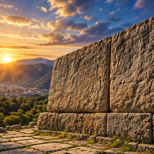
At Baalbek, the engineering problem can be followed from bedrock to finished monument. Three colossal limestone blocks, traditionally called the Trilithon, were transported from the quarry zone and incorporated into the western podium of the sanctuary of Jupiter. Nearby quarries preserve even larger blocks that were cut and prepared but never moved. The starting point survives. The destination survives. What continues to be studied is the exact machinery, road preparation, hauling sequence and lifting procedure that connected the two.
Engineering exhibit illustration. The three colossal blocks of the Trilithon are shown as the central physical problem. Measurements and weight figures are approximate and should be read as archaeological and engineering estimates rather than exact original construction specifications.
LocationBaalbek, Lebanon
MonumentJupiter sanctuary podium
Trilithon3 colossal blocks
Block lengthAbout 19 m each
Installed weightUp to about 800 t
MaterialLocal limestone
Largest quarry blockAbout 1,650 t estimated
Exact transport systemNot preserved
Physical Record
What Is Actually There?
Feature
Physical record
Evidence class
The Trilithon
Three enormous limestone blocks form part of the western podium wall of the Jupiter sanctuary. Each is approximately 19 m long.
Observed / measured
Installed mass
Engineering literature commonly places the largest installed podium blocks at up to approximately 800 metric tons.
Calculated estimate
Southern quarry
A major ancient limestone quarry survives south of the sanctuary, preserving extraction surfaces, unfinished blocks and traces connected with quarry work.
Observed
Hajjar al-Hibla
The famous unfinished monolith remains in the quarry. A major karst surface and crack are documented, which may explain why it was abandoned.
Observed / interpretation
Largest excavated quarry block
A still larger block was exposed north of Hajjar al-Hibla, measuring about 19.6 × 6 × 5.6 m and estimated at roughly 1,650 metric tons.
Measured / calculated estimate
Transport traces
Quarry investigations documented abrasion traces associated with a transport winch on another block.
Observed / interpreted feature
Critical distinction: The approximately 1,650-ton block was prepared in the quarry but was not transported to the sanctuary. The engineering achievement demonstrated at the monument is the movement and installation of blocks reaching approximately 800 tons. The unfinished giants show what quarry workers attempted, not what they successfully delivered.
Construction Chronology
An Ancient Site, but Not One Construction Date
Baalbek contains a deep sequence of occupation. Archaeological work inside the Jupiter sanctuary traces settlement layers back into the Pre-Pottery Neolithic, with later Bronze Age and Iron Age activity. That early occupation does not date the Trilithon. The monumental sanctuary visible today developed much later, particularly under Roman rule. Quarry ceramics and quarrying evidence associated with the giant blocks point to activity in the early Roman Imperial period.
Museum dating rule: Early occupation beneath Baalbek and the construction date of the megalithic podium are separate questions. Evidence that people occupied the site thousands of years earlier cannot by itself be used to assign the Trilithon to that earlier occupation.
The Quarry Dilemma
The Stones That Never Left
The southern quarry is one of the most valuable pieces of the Baalbek engineering record because it preserves the production side of the project. Here enormous limestone masses were isolated from the bedrock and prepared as rectangular blocks. Some were abandoned before transport. Their size allows us to compare the ambitions of the quarry operation with the blocks that actually reached the sanctuary.
Quarry and terrain study. The illustration visualizes the relationship between the southern quarry and the sanctuary. Route lines are interpretive unless tied to a documented ancient road surface. The surviving quarry and sanctuary locations are real; the exact path taken by every transported megalith is not known.
Stone
Approximate condition
Engineering significance
Trilithon blocks
Approximately 19 m long; up to about 800 t each.
Transported and incorporated into the podium. These establish that very large megalith movement actually occurred.
Hajjar al-Hibla
Enormous unfinished quarry block, traditionally estimated at roughly 1,000 t.
Never delivered. Cracking and poor stone quality are among the documented reasons proposed for abandonment.
Additional giant block
Another very large worked block is documented in the quarry, often estimated above 1,000 t.
Shows that quarrying plans extended beyond the scale of the installed Trilithon.
Largest excavated block
About 19.6 × 6 × 5.6 m; approximately 1,650 t calculated.
Prepared on all four sides but left in the quarry. DAI researchers interpret its dimensions as evidence that it may have been intended for another course of the Jupiter podium.
Engineering Problem
From Quarry to Podium
The existence of the installed Trilithon removes one easy answer: the stones were not simply too large to move. At least three blocks approaching the upper range of ancient megalithic transport were successfully removed from their source area, moved to the sanctuary and positioned in a monumental wall. What has not survived is a complete construction system that can be identified as the historical method.
Established
Horizontal movement happened
The installed stones themselves demonstrate successful transport. Quarry evidence also preserves traces interpreted as connected with transport equipment. The physical question is therefore not whether ancient builders could move very heavy limestone at Baalbek, but exactly how they organized and controlled that movement.
Transportation Theories
How Could an 800-Ton Block Be Controlled?
Published engineering discussions have explored combinations of sledges, prepared tracks, rollers, levers, capstans, winches, pulley systems, earthen ramps and controlled lifting or lowering. These ideas are useful because they can be tested against force, friction, timber strength, rope capacity, terrain and available working space. They remain reconstructions unless a particular arrangement can be tied directly to archaeological traces at Baalbek.
Comparative hypothesis illustration. Mechanical systems shown here are proposed engineering possibilities, not a record of the actual Baalbek operation. Any depiction of levitation, supernatural assistance or priestly power belongs to the category of extraordinary account or later exploration and is not archaeological evidence.
Proposed method
Engineering logic
Evidence status at Baalbek
Sledge on prepared surface
Spreads the load and allows a large pulling force to be applied while controlling the block as one mass.
Attempts to reduce sliding resistance or provide a controlled bearing surface.
Proposed; material and load limits must be demonstrated.
Capstans / winches
Convert repeated human or animal effort into controlled pulling force. Quarry abrasion interpreted as a transport-winch trace makes hauling machinery especially relevant.
Mechanically plausible with archaeological clue, but full system unknown.
Levers
Allow incremental movement, alignment and adjustment of a massive load.
General ancient technique; exact Baalbek sequence unproven.
Earthen ramps and embankments
Reduce the need for a single dramatic vertical lift by bringing the transport surface closer to final elevation.
Engineering hypothesis; temporary works are not preserved well enough to establish one design.
Counterweights / opposing anchors
Could multiply control or restrain a descending or rising load when combined with ropes and mechanical advantage.
Testable engineering concept; not established as the Baalbek method.
Water-assisted or flooded-surface movement
Reducing friction with water or using a prepared wet surface can be explored mechanically, but true flotation of an 800-ton stone would require a very large displacement system.
exploratory for Baalbek. No established flooded transport corridor currently demonstrates this method.
Levitation / supernatural movement
Later extraordinary accounts sometimes invoke spiritual, sonic or supernatural force rather than mechanical transport.
No archaeological or demonstrated engineering evidence.
Engineering boundary: A method can be physically possible without being historically demonstrated. Collection IV distinguishes a successful modern reconstruction from proof that the ancient builders used that exact procedure.
Final Placement
The Problem Does Not End at Transportation
Delivering a block to the sanctuary was only part of the task. The builders also had to control its orientation, elevation, lateral alignment and final bedding while avoiding catastrophic cracking. The Trilithon blocks form part of a carefully organized podium rather than a random pile of megaliths. Any complete reconstruction must therefore explain both transport and precision placement.
EstablishedThree giant blocks arrived
The Trilithon is physically incorporated into the podium.
EstablishedQuarry work survives
Unfinished blocks and quarry traces preserve part of the production sequence.
Datable quarry material and construction research connect the giant-block operation with the Roman monumental program.
under continued studyExact transport and setting system
Scientific literature still discusses hypotheses for horizontal and vertical megalith movement.
Orientation & Site Planning
A Monument Planned as a Whole
The Jupiter sanctuary was laid out as a monumental architectural complex with a strong principal axis, terraces, courts and podium structures. Orientation can be measured directly from the surviving plan. Proposed astronomical or calendrical meanings for that axis belong to interpretation and should not be treated as established simply because an alignment can be calculated.
Alignment rule: The architectural axis is measurable. The reason the builders selected that orientation is a separate question. Landscape, earlier sacred topography, urban planning, ritual movement and astronomical considerations may all be investigated, but proposed meaning must remain labeled as proposed.
Evidence Assessment
What Baalbek Actually Establishes
areas for further study
What exact transport apparatus moved the Trilithon? The result survives, but the complete hauling system does not.
What route preparation was required? A successful reconstruction must account for gradients, bearing pressure, turns, braking and the enormous concentrated load.
How were the blocks brought to final elevation? Horizontal hauling alone does not explain final placement within the podium.
Why were the largest quarry blocks abandoned? Cracks and stone quality explain at least some abandonment, while the largest block may also preserve a change in building plan or practical limit.
Where was the practical engineering limit? Baalbek preserves an unusual comparison between approximately 800-ton blocks that moved and blocks above 1,000 tons that did not.
Research Sources
German Archaeological Institute (DAI), Baalbek quarry excavations and research on the Jupiter sanctuary, including Margarete van Ess and the Lebanese-German Baalbek project.
BTU Cottbus-Senftenberg, History of Construction research project, Ancient Transport Techniques, examining horizontal and vertical transport options for the Baalbek megaliths.
German Archaeological Institute, research on the Neolithic through Iron Age settlement sequence beneath the Jupiter sanctuary.
Jean-Pierre Adam, À propos du trilithon de Baalbek: Le transport et la mise en oeuvre des mégalithes, Syria 54 (1977), an influential engineering reconstruction of megalith transport and placement.
03Exhibit 03Sigiriya: Fortress in the SkyMatale District, Central Province, Sri Lanka
Sigiriya: Fortress in the Sky
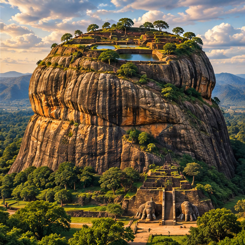
Sigiriya presents a different engineering problem from Nan Madol and Baalbek. Here the challenge was not the movement of a few exceptionally heavy megaliths, but the transformation of a natural rock mass rising about 180 m (590 ft) above the surrounding plain into a fortified royal complex. During the reign of King Kashyapa I, approximately AD 477–495, builders combined summit architecture, brick and masonry construction, rock modification, galleries, stairways, gardens, moats and sophisticated water management into one integrated landscape.
Engineering overview. The plate brings the major architectural zones into one visual study. Some reconstructed buildings and temporary construction systems are interpretive. The surviving rock, archaeological remains, gardens, pools, terraces and access features provide the physical basis for the investigation below.
Sigiriya is a natural rock formation, not a mountain carved wholesale into the shape visible today. Ancient builders nevertheless modified the rock extensively and treated it as part of the architecture. At the summit they created terraces, foundations, walls, circulation routes and water-storage features. Lower down they integrated natural boulders into gardens and structures, constructed galleries against the cliff, built stairways through steep terrain and developed the monumental Lion Gate as part of the final ascent.
Established
The rock is natural
The approximately 180 m monolith existed before the royal complex. The engineering achievement lies in adapting its summit, slopes and surrounding landscape for architecture, movement, defense, display and water control.
Location & Site Plan
From the Indian Ocean to the Rock
Sigiriya lies in the Matale District of Sri Lanka's Central Province, near Dambulla. Its setting matters because the fortress was not an isolated summit building. The rock stands at the center of a deliberately organized landscape whose western approach includes moats, geometric water gardens, boulder gardens, terraced gardens and a controlled ascent toward the upper complex.
Location and site-plan study. The map moves from the Indian Ocean to Sri Lanka, then to the central region and the Sigiriya complex. The site plan emphasizes the relationship between the rock, formal gardens, moats and ascent route rather than treating the summit as a structure standing alone.
Construction Chronology
An Older Landscape, a 5th-Century Royal Transformation
Human use of the Sigiriya landscape predates King Kashyapa. Rock shelters and inscriptions preserve evidence of earlier Buddhist monastic activity, including use in the centuries BC. The monumental royal transformation for which Sigiriya is famous belongs principally to the reign of Kashyapa I, approximately AD 477–495. Earlier occupation therefore should not be used to assign the summit palace and hydraulic landscape to a prehistoric construction date.
Museum dating rule: Evidence that a place was occupied earlier is not automatically evidence that every surviving monument at that place is equally old. Sigiriya's earlier monastic history and its late 5th-century AD royal construction phase are separate parts of the archaeological sequence.
Vertical Engineering
The 590-Foot Logistics Problem
The summit ruins imply a continuous construction supply problem. Workers, brick, timber, plaster, tools, food and other materials had to reach work areas hundreds of feet above the plain. Ancient access features demonstrate that people could ascend the rock, but the temporary machinery used during construction has not survived as a complete system. A convincing engineering reconstruction must explain not only how people climbed Sigiriya after completion, but how builders created the access routes, galleries and summit works in the first place.
Vertical engineering study. The side view places the summit, cliff galleries, Lion Gate and lower landscape into one elevation problem. Modern stairs and safety structures should not be mistaken for the ancient construction system. Proposed hoists, scaffolds or lifting stages remain engineering reconstructions unless supported by archaeological traces.
Engineering problem
What the site establishes
What remains reconstructed
Workers reaching the summit
Ancient routes, galleries and stairways demonstrate organized vertical circulation.
The temporary access used before permanent routes were complete.
Moving building materials
Constructed architecture at high elevations proves that material reached those elevations.
Exact use of ropes, baskets, hoists, winches, ramps, sledges or staged platforms.
Cliff-face work
Plastered and painted surfaces and constructed galleries survive on steep faces.
Scaffolding design, anchor points, work platforms and safety procedures.
Summit preparation
Terraces, foundations, walls and pools show deliberate adaptation of the summit.
The detailed sequence of cutting, leveling, filling and construction.
The Fresco & Gallery Problem
Building on an Exposed Cliff Face
The famous paintings and gallery system add another engineering dimension. Artisans did not merely decorate a convenient ground-level wall. Work areas were established high on the rock face, requiring access, stable working surfaces, plaster preparation and the repeated movement of people and supplies. The surviving result is clear. The complete temporary scaffold or platform system that made the work possible is not.
Water Engineering
Water at the Summit, Water in the Gardens
Water management is one of Sigiriya's strongest pieces of engineering evidence. The lower complex contains carefully planned pools, channels, fountains and moats integrated with the landscape. Water-storage features also survive on the summit. These systems demonstrate sophisticated control of rainfall, storage, drainage, gravity and landscape hydraulics, but the upper and lower systems should not be joined into an imaginary pumping machine without evidence.
Hydraulic investigation. Rainfall collection at the summit and the extensive lower garden hydraulics are important parts of the physical record. Internal filtration layers, hidden channels or continuous summit-to-garden flow shown in a conceptual cutaway should be read as explanatory engineering possibilities unless individually documented archaeologically.
EstablishedSummit water features survive
Rock-cut and constructed basins demonstrate deliberate water storage at high elevation.
EstablishedLower hydraulics were sophisticated
Gardens, channels, pools, fountains and moats form an integrated designed landscape.
Engineering inferenceRainfall was essential
At summit elevation, rainfall collection and storage provide a straightforward source that fits the surviving reservoirs.
Not establishedNo proven 590-ft pump
The existence of lower waterworks does not by itself demonstrate that water was mechanically pumped from the plain to the summit.
Landscape Engineering
The Fortress Begins Before the Rock
The formal western gardens reveal geometric planning on a large scale. Pools, channels, fountains, paths and moats establish controlled approaches and strong visual axes. Boulder gardens then exploit the natural terrain before the ascent becomes increasingly vertical. The result is a progression from engineered landscape to engineered mountain, with architecture and topography designed to work together.
Orientation & Alignment
A Strong Planned Axis, but Why?
The western garden and approach system displays a clearly planned geometric relationship to the rock and palace complex. Researchers have also explored possible solar relationships in Sigiriya's orientation, including proposed connections with the tropical zenithal sun. Such interpretations are worth documenting, but a measurable alignment is not the same as proof of the builders' intended astronomical meaning.
Alignment status: Deliberate geometric planning of the approach and landscape is established by the site plan. Specific astronomical or calendrical meanings remain proposed interpretations unless supported by additional historical or archaeological evidence.
Engineering Theories
How Might the Builders Have Worked at Height?
Rope hoists, baskets, timber scaffolds, staged platforms, inclined transport surfaces, sledges and simple lifting machines are all mechanically reasonable technologies to test when reconstructing Sigiriya. The important museum distinction is that a method can be plausible without being demonstrated as the historical method. The finished architecture proves that a successful logistical system existed. It does not preserve every temporary machine used to create it.
Proposed method
Possible role
Evidence status
Rope and basket hoisting
Moving smaller loads, tools and supplies between levels.
Mechanically plausible; exact Sigiriya rigging not preserved.
Timber scaffolding
Providing work platforms on steep faces and around galleries.
Likely type of temporary technology; specific configuration under continued study.
Staged lifting platforms
Moving material progressively rather than in one 590-ft lift.
Engineering reconstruction.
Inclined routes and sledges
Moving heavier loads where terrain allowed gradual ascent.
Possible in selected areas; not a complete explanation for sheer faces.
Winches or pulley systems
Multiplying force and controlling loads at exposed elevations.
Plausible ancient mechanical principle; exact site system unproven.
Evidence Assessment
What Sigiriya Actually Establishes
areas for further study
How were materials moved through the steepest stages of construction? The permanent architecture survives, while most temporary lifting and staging equipment does not.
What did the ancient cliff scaffolding look like? High-elevation plaster, paintings and galleries imply stable working platforms, but their complete form is unrecovered.
How was the summit construction sequenced? Access, terraces, reservoirs and buildings had to be coordinated while the work site itself was still developing.
How was summit water managed through seasonal variation? Storage features survive, but day-to-day operation, consumption and reserve strategy must be reconstructed indirectly.
How much of the summit was cut, leveled or built up? Natural rock and constructed surfaces interact closely, making the engineering sequence an important archaeological question.
Were any major axes intentionally astronomical? Proposed solar relationships can be tested geometrically, but intentional meaning remains a separate evidentiary question.
Interesting Facts
The Lion was once much larger
The surviving paws at the Lion Gate are remnants of a monumental lion composition through which the upper ascent once passed. The complete upper form no longer survives.
Fountains still demonstrate the hydraulic concept
Parts of the lower water-garden system remain capable of functioning under suitable water conditions, providing unusually direct evidence of the site's hydraulic design.
The rock was part of the design
Natural boulders, cliff faces and the summit were not obstacles merely cleared away. Builders incorporated them into gardens, routes, architecture and defensive planning.
It was more than a fortress
Palatial architecture, gardens, paintings, water features and carefully staged approaches show that display, ceremony and landscape design were as important as defensibility.
Research Sources
UNESCO World Heritage Centre, Ancient City of Sigiriya, World Heritage listing and supporting documentation.
Central Cultural Fund of Sri Lanka, Sigiriya heritage-site documentation on the fortress, gardens and hydraulic system.
Archaeological Survey and cultural-heritage research on Sigiriya's monastic occupation, Kashyapa-period royal complex, paintings, gardens and summit remains.
Published archaeoastronomical research proposing solar relationships in the planned orientation of the Sigiriya complex. Astronomical intention is treated here as proposed rather than established.
04Exhibit 04Rujm el-Hiri: The Wheel of GiantsGolan Heights, Ancient Bashan
Rujm el-Hiri: The Wheel of Giants
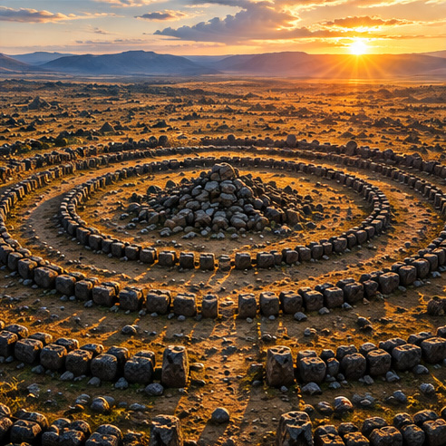
Rujm el-Hiri is included in Collection IV with a chronology qualification. The monument stands within the basalt landscape of the Golan Heights, in the broader region associated with ancient Bashan. Its great concentric walls may belong to a construction horizon that archaeological studies have placed anywhere from the Chalcolithic through the Bronze Age. Some proposed dates fall before the Flood in a traditional Ussher biblical chronology, while nearby dolmens and later megalithic activity extend into archaeological periods that fall after that traditional Flood date. The exhibit therefore treats Rujm el-Hiri as a chronological bridge rather than forcing the entire landscape into one period.
The physical monument. Rujm el-Hiri is best understood from above. Concentric basalt walls, radial divisions, major openings and the central cairn form a monumental plan more than 150 meters across. The illustration is interpretive; measurements and archaeological evidence are documented below.
LocationCentral Golan Heights
Historic regionBroader Bashan landscape
Outer diameterAbout 150–156 m / 492–512 ft
MaterialLocal volcanic basalt
Central cairnAbout 20 m / 66 ft across
Estimated stone massTens of thousands of tons
Original functionunder continued study
Chronologyunder continued study / multi-phase
Physical Record
Basalt walls, entrances, radial divisions and the central cairn survive and can be surveyed.
Measured Evidence
Dimensions, geometry, sediments, artifacts and landscape relationships provide testable evidence.
Engineering Inference
Surveying, labor organization and construction sequence can be reconstructed only in part.
Biblical Geography
Scripture associates Bashan with Og and the Rephaim. This does not identify the monument's builders.
Why This Engineering Wonder Belongs Here
Rujm el-Hiri presents a different engineering problem from Nan Madol, Baalbek and Sigiriya. Its achievement is not one impossibly heavy stone or one inaccessible summit. It is large-scale geometric organization. Builders gathered enormous quantities of basalt and arranged them into concentric walls and radial divisions across an area more than 500 feet wide. The finished plan implies surveying, repeated measurement, controlled radii, labor coordination, stone transport within the landscape and a construction sequence that maintained the geometry while thousands of individual stones were placed.
Engineering question: How did builders working at ground level establish and maintain the geometry of a monument too large to comprehend from a single standing viewpoint? Stakes, cords, measured radii and sight lines are mechanically plausible tools, but the actual surveying system has not survived.
Physical Record and Measured Evidence
Feature
Approximate evidence
Museum assessment
Overall plan
Multiple concentric basalt walls connected in places by radial walls.
Directly observable and surveyed.
Outer diameter
Approximately 150–156 m, about 492–512 ft.
Measured; published values vary slightly by survey.
Outer wall
Approximately 3.2 m wide in published architectural descriptions, with substantial surviving height in places.
Measured physical architecture.
Central cairn
Approximately 20 m, about 66 ft, in diameter and roughly 5 m, about 16 ft, high.
Measured physical feature; its relationship to the earliest rings continues to be studied.
Stone mass
Published estimates commonly place the total in the tens of thousands of tons.
Engineering estimate, not an ancient recorded specification.
Building stone
Basalt characteristic of the volcanic Golan landscape.
Local geological resource.
Where Did the Stone Come From?
Unlike Baalbek, Rujm el-Hiri does not require a distant limestone quarry to explain its raw material. The central Golan is a volcanic basalt landscape, and basalt blocks occur naturally throughout the surrounding terrain. This reduces the long-distance quarry problem, but it does not remove the engineering problem. Builders still had to select, gather, move, sort and place a tremendous volume of irregular stone while preserving an enormous architectural plan.
The Chronology Problem
Rujm el-Hiri cannot responsibly be assigned one absolute construction year. Archaeological interpretations have ranged from the Chalcolithic through the Early and Late Bronze Ages. Aveni and Mizrachi interpreted the concentric ceremonial complex within an Early Bronze Age framework and treated the central cairn as substantially later. Freikman and Porat later argued that the monument's beginnings may reach into the Chalcolithic, using landscape archaeology and OSL evidence as part of their case. Recent reassessment continues to describe both the date and purpose as under continued study.
Approximate comparison point used in this exhibit: c. 3000 BC. This is not presented as the proven year of construction. It is a useful point within one major archaeological horizon for comparing the monument with traditional biblical chronology.
Biblical Chronology Comparison
The following comparison uses the traditional Ussher chronology. The ages of the patriarchs derive from Genesis 5; converting those genealogical intervals into BC dates depends upon the chronological system chosen.
Approximate date
Traditional Ussher comparison
3382 BC
Enoch born
3317 BC
Methuselah born
3130 BC
Lamech born
c. 3000 BC
Approximate archaeological comparison point for Rujm el-Hiri. Methuselah and Lamech would be living in this chronology.
3017 BC
Enoch translated, approximately 17 years before the c. 3000 BC comparison point
2948 BC
Noah born
2349/2348 BC
Flood in traditional Ussher chronology
A chronological gray area: If a principal phase of Rujm el-Hiri belongs near 3000 BC, traditional Ussher chronology places it before the Flood. The surrounding megalithic landscape, however, includes dolmens and later use that archaeological research places in subsequent periods. Collection IV therefore preserves the chronological tension rather than assigning every structure in Bashan to one construction event.
Landscape and biblical-geography map. Biblical place names and archaeological monuments represent different evidence categories. Geographic proximity does not by itself establish cultural identity or authorship.
Bashan, Og and the Rephaim
The biblical connection is geographical and textual. The Old Testament repeatedly associates Bashan with Og and the Rephaim. The KJV renders Rephaim as “giants” in key passages. This is one reason the modern Hebrew name Gilgal Refaim has become popularly rendered “Wheel of Giants.” The name is intriguing, but it is not archaeological proof that the biblical Rephaim constructed the monument.
Deuteronomy 3:11 · KJV
“For only Og king of Bashan remained of the remnant of giants; behold, his bedstead was a bedstead of iron; is it not in Rabbath of the children of Ammon? nine cubits was the length thereof, and four cubits the breadth of it, after the cubit of a man.”
Deuteronomy 3:13 · KJV
“And the rest of Gilead, and all Bashan, being the kingdom of Og, gave I unto the half tribe of Manasseh; all the region of Argob, with all Bashan, which was called the land of giants.”
Joshua 12:4 · KJV
“And the coast of Og king of Bashan, which was of the remnant of the giants, that dwelt at Ashtaroth and at Edrei,”
The Dolmen Landscape Around Rujm el-Hiri
The great stone circle is not isolated. The Golan and adjacent northern landscapes contain extensive fields of dolmens, cairns, walls and other megalithic features. At Shamir and Kela, researchers have investigated large basalt dolmens whose chambers were constructed from standing megalithic slabs and capped by massive stones. This wider landscape demonstrates a long-lived regional tradition of building monumentally with basalt, while also warning us not to assume that every monument belongs to the same generation.
How Were the Nearby Dolmens Dated?
For generations, Southern Levant dolmens were dated largely by pottery, beads, metal objects and other finds recovered from their chambers. Those chambers were frequently reused, which complicated the chronology. In 2023, researchers applied Optically Stimulated Luminescence, OSL, to sediments from dolmens at Shamir and Kela. Their results supported an Intermediate Bronze Age construction horizon for those northern Israeli dolmens and also detected complicated later histories of sediment accumulation and reuse.
What OSL dates: OSL estimates when mineral grains in sediment were last sufficiently exposed to light before burial. It does not directly date when a basalt boulder formed, and a sediment age must still be interpreted within its archaeological context.
Geometry, Surveying and Astronomical Alignment
Rujm el-Hiri has long attracted archaeoastronomical study because of its large-scale geometry and prominent openings. Aveni and Mizrachi examined architectural alignments with celestial events, landscape features and seasonal phenomena and proposed that the complex may have incorporated calendrical observations. This remains an interpretation rather than an established function.
Later researchers emphasized landscape relationships and questioned whether broad entrances would have functioned as precise astronomical sighting devices. Recent remote-sensing and geophysical work adds another complication: long-term tectonic movement may have altered the monument's present orientation relative to its ancient position. Modern azimuths therefore cannot simply be projected backward without accounting for geological change.
What Rujm el-Hiri Actually Establishes
areas for further study
When was the first major ring complex constructed? Competing archaeological models place its beginnings in different prehistoric periods.
Was the central cairn part of the original plan? Some interpretations treat the funerary feature as a later addition.
What was the monument for? Ceremonial gathering, funerary use, territorial symbolism, seasonal activity and astronomical functions have all been discussed.
How was the geometry laid out? The finished monument demonstrates planning, but the builders' surveying tools and field procedures are not preserved.
Is there any connection with the biblical Rephaim? The geographical overlap is real and worthy of documentation. A direct archaeological identification of the builders with the Rephaim has not been established.
Does the landscape cross the museum's Flood boundary? Under traditional Ussher chronology, some proposed dates for Rujm el-Hiri are pre-Flood while later dolmen horizons are post-Flood. The archaeological landscape is multi-period, so the museum keeps the evidence visible rather than forcing one date onto all of it.
Research Sources
Aveni, Anthony F. and Yonathan Mizrachi, The Geometry and Astronomy of Rujm el-Hiri, a Megalithic Site in the Southern Levant, Journal of Field Archaeology 25(4), 1998.
Freikman, Michael and Naomi Porat, Rujm el-Hiri: The Monument in the Landscape, Tel Aviv 44(1), 2017.
Reed, Kristina S., Uri Berger, Gonen Sharon and Naomi Porat, Radiometric dating of Southern Levant dolmens: Applying OSL to resolve an old study, Journal of Archaeological Science: Reports 49, 2023.
Recent aerial-imagery and remote-sensing reassessments of Rujm el-Hiri and the surrounding proto-historic stone-circle landscape.
The Holy Bible, King James Version: Genesis 5; Deuteronomy 3; Joshua 12.
05Exhibit 05The Great Pyramid of GizaGiza Plateau, Giza, Egypt
The Great Pyramid of Giza
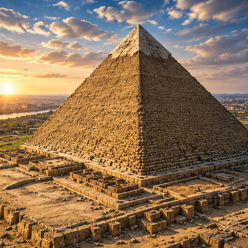
The Great Pyramid is an engineering problem measured on several scales at once. It combines an enormous stone mass, a carefully leveled base, near-cardinal orientation, long-distance transport of specialized stone, internal chambers and passages, and a construction sequence that raised masonry to an original height of about 146.6 m, or 481 ft. Archaeology strongly associates the monument with the Fourth Dynasty king Khufu, but important details of quarrying logistics, lifting, temporary works and construction sequencing remain subjects of active research.
Also in Collection VI: This exhibit studies the Great Pyramid as an engineering problem. The Seven Wonders collection examines why ancient observers celebrated it, including its original appearance, monumental scale, antiquity, historical reputation, and unique survival.
Great Pyramid · Seven Wonders Exhibit →
Chronology qualification: conventional Egyptological chronology places Khufu and the Great Pyramid in the mid-third millennium BC, commonly around 2550 BC. In a traditional Ussher chronology, which places the Flood around 2349/2348 BC, that conventional date falls before the Flood. The monument is retained in this engineering collection as another chronology-crossing case study. The archaeological date and the biblical chronology are shown separately rather than forced into agreement.
Engineering overview. The cutaway is an interpretive visualization of the known internal system. Dimensions below should be treated as the governing evidence where an illustration simplifies or compresses geometry.
MonumentGreat Pyramid of Khufu
Original height146.6 m / 481 ft
Base sideAbout 230.3 m / 756 ft
Original slopeAbout 51° 50′
OrientationNear true cardinal
Core materialGiza limestone
CasingFine Tura limestone
Interior graniteAswan region
Conventional builderKhufu, Dynasty 4
Exact lifting systemunder continued study
Physical Record
The pyramid, quarry traces, masonry, passages, chambers and surrounding construction landscape survive.
Measured Evidence
Modern surveys document orientation, dimensions, slope, internal geometry and stone characteristics.
Documentary Evidence
Old Kingdom records, especially the diary of Merer, document movement of limestone connected with Khufu's building project.
Engineering Inference
Ramps, sledges, levers, hauling systems and construction sequences are reconstructed from physical constraints and comparative evidence.
Why the Great Pyramid Belongs in an Engineering Collection
The Great Pyramid is not remarkable because one impossible stone had to be moved. Its achievement is the integration of millions of individual operations into one controlled geometric structure. Quarrying, dressing, transport, leveling, orientation, course planning, passage construction, granite placement, casing and workforce supply all had to function together while the monument continuously changed shape and height.
The central engineering question: not simply “How did they lift a block?” but “How did an Old Kingdom project maintain surveying control, material flow, labor coordination and placement accuracy over an enormous structure for years of continuous construction?”
Physical Record
Feature
What survives
Evidence status
Pyramid core
Hundreds of courses of locally quarried limestone masonry survive on the Giza Plateau.
Direct physical record
Casing remnants
Fine limestone casing and backing stones survive in limited areas around the base.
Direct physical record
King's Chamber
Massive granite walls, floor and ceiling elements remain in place.
Direct physical record
Grand Gallery
A high corbelled passage rising through the masonry core.
Direct physical record
Descending and ascending systems
Precisely laid sloping passages connect the subterranean and upper internal spaces.
Direct physical record
Hidden voids
Muon imaging has confirmed previously unknown void space above the Grand Gallery and a corridor behind the north-face chevrons.
Measured by multiple non-destructive techniques; purpose under continued study
Construction Attribution
The Great Pyramid is archaeologically associated with Pharaoh Khufu. The attribution is supported by the pyramid complex as a whole, Fourth Dynasty context, inscriptions and crew marks in internal construction spaces, and documentary evidence from the reign of Khufu. The Wadi al-Jarf papyri are especially important because the diary of an official named Merer describes teams transporting fine limestone from the Tura region toward Akhet-Khufu, “Horizon of Khufu,” during Khufu's reign.
What the Merer papyri establish: organized water transport of building stone connected with Khufu's pyramid project. What they do not establish: the complete ramp system, final lifting method or exact placement procedure for every block.
Material Logistics
Quarry to Pyramid
The pyramid used different stones for different engineering jobs. Most core limestone could be obtained on or close to the Giza Plateau. Fine white limestone used for the casing came from quarries on the eastern side of the Nile in the Tura region. Granite used in the King's Chamber and other major internal elements came from the Aswan region, hundreds of miles to the south. That material diversity required a logistics network linking quarry, river, harbor or canal, unloading area and construction front.
Material network. The illustration distinguishes local Giza limestone, Tura casing limestone and Aswan granite. Water transport is directly supported by Old Kingdom documentary evidence, while particular overland haul routes and unloading arrangements remain reconstructed from archaeology and terrain.
Material
Likely source
Use
Engineering consequence
Local limestone
Giza Plateau and nearby quarries
Bulk of core masonry
Reduced long-distance transport for the enormous majority of the stone mass.
Fine limestone
Tura / Maasara quarry district
Outer casing and selected finished masonry
Required quarrying across the Nile system and organized boat transport.
Granite
Aswan region
King's Chamber and major structural elements
Required long-distance river transport and difficult final lifting because individual granite elements are very heavy.
Mortar and gypsum materials
Regional sources
Bedding and gap filling
Allowed courses and selected joints to be seated and adjusted.
Vertical Construction
The Lifting Problem
No surviving Old Kingdom construction manual gives a complete step-by-step method for raising every course of Khufu's pyramid. Ramps are strongly supported as a general Egyptian building technology, and sledges, ropes and levers are archaeologically credible tools. What remains under continued study is the exact geometry and sequence of temporary works used as the pyramid grew taller and available working space changed.
Engineering theories. Straight ramps, wrapping ramps, internal-ramp concepts and combinations of sledges, levers and hauling systems are reconstructions. Archaeology supports ramps and hauling technology in ancient Egypt generally, but no single illustrated scheme has been demonstrated as the complete historical method used for the Great Pyramid.
Proposed system
Engineering advantage
Principal difficulty
Museum status
Straight ramp
Simple hauling geometry and direct approach.
A shallow ramp to great height becomes extremely long and material-intensive.
Plausible for some phases; complete full-height version under continued study.
Wrapping / spiral ramp
Keeps ramp length close to monument.
Turns, survey visibility and changing working surfaces become difficult.
Engineering hypothesis.
Internal or edge-integrated ramp
Reduces external ramp footprint and may allow staged closure.
Requires a complex construction sequence and specific internal traces.
Modern hypothesis under active modeling.
Sledge and lever combinations
Allows incremental movement, placement and fine adjustment.
Does not by itself explain the entire vertical logistics network.
Strongly plausible component technology.
Pulley-like or counterweight systems
Can multiply or redirect force and control loads.
Specific proposed configurations remain widely discussed and must match Old Kingdom evidence.
Hypothesis, not established construction history.
Surveying and Geometry
Precision and Alignment
The Great Pyramid's orientation is one of its most securely measured engineering achievements. Modern surveys confirm that its sides were laid out extremely close to the cardinal directions. Published results differ slightly according to which surviving casing, platform and structural lines are reconstructed, but the deviation is measured in only a few arc minutes rather than whole degrees.
Precision study. The image visualizes cardinal orientation, slope, base geometry and fine masonry. Exact values vary slightly between historic and modern surveys. The HTML evidence below takes precedence over simplified labels in the illustration.
Measurement
Evidence
Interpretation
Cardinal orientation
Modern and historic surveys place the sides within only a few arc minutes of the cardinal directions.
Established surveying achievement. The exact ancient sighting method remains reconstructed.
Base dimensions
Reconstructed original side length is about 230.3 m, approximately 756 ft.
Measured and reconstructed from surviving platform and casing evidence.
Slope
Approximately 51° 50′, commonly related to an Egyptian seked of about 5½ palms.
Measured geometry with a plausible indigenous Egyptian design framework.
Casing joints
Surviving fine casing masonry demonstrates very close dressing in selected locations.
Exceptional workmanship is established, but tiny joint measurements should not be generalized to every core block.
Passage angles
Long internal passages maintain controlled slopes and alignments through the masonry.
Directly measurable engineering.
How Was True North Found?
Researchers have proposed several methods, including observations of circumpolar stars, simultaneous stellar transits, solar-shadow methods and carefully established east-west lines. Egyptian surveyors possessed cords, plumb devices, leveling methods and standardized measuring rods. The resulting orientation is measurable; the precise ritual and observational procedure used to establish it at Khufu's pyramid is not recorded in a surviving construction text.
Granite Above the King's Chamber
The King's Chamber is one of the most demanding internal construction problems. It uses massive Aswan granite, including large ceiling beams, and above it are additional granite and limestone spaces traditionally called relieving chambers. Whatever their precise structural behavior and construction sequence, these elements required heavy stone to be transported from southern Egypt, delivered to Giza, raised to a substantial elevation and placed before the overlying pyramid mass closed around them.
Engineering consequence: any complete construction model must explain not just ordinary limestone courses, but the timing and controlled placement of unusually heavy granite elements inside the rising monument.
Darkness Inside the Pyramid: How Did Builders See?
This is a legitimate construction question, but one popular account needs to be separated from the evidence. It is often stated that the Great Pyramid contains “no soot” and therefore torches or lamps could not have been used. That statement is too absolute. The monument has experienced ancient activity, later entry, historical visitation and modern contamination, and surface staining alone cannot securely reconstruct the original lighting system.
Established
Much work occurred before enclosure
Internal rooms and passages were constructed as surrounding masonry rose. Builders did not necessarily have to complete every task by carrying light through the fully finished tunnel system we experience today. Open construction stages could provide daylight from above or from incomplete walls.
Known technology
Lamps were available
Ancient Egyptians used oil or fat lamps and wicks in other contexts. The precise lighting equipment used during Great Pyramid construction has not been recovered as a complete system.
Could Mirrors Have Directed Sunlight Inside?
Polished metal mirrors existed in ancient Egypt, so reflection is physically possible. A mirror can redirect sunlight through an opening, but each reflection loses intensity and the long, turning geometry of passages makes a chain of mirrors progressively less effective. No archaeological installation of mirrors has been recovered inside the Great Pyramid that demonstrates a permanent reflected-light system.
Museum classification: mirror-assisted lighting is a testable engineering idea, not an established Great Pyramid construction method.
Was There an Electric Light Source?
No electrical generator, wiring network, electrodes, sockets, lamps or other technological system demonstrating ancient electric lighting has been recovered from the Great Pyramid or its Old Kingdom construction context. accounts that the pyramid functioned as an electrical power station therefore remain extraordinary hypotheses rather than archaeological conclusions.
Important distinction: the absence of an identified soot layer is not positive evidence for electricity. To establish ancient electrical lighting, researchers would need physical components, manufacturing evidence, conductive systems, residues or other independently testable archaeological traces.
Sound, Resonance and “Acoustic Anomalies”
Visitors and researchers have long noticed that the granite King's Chamber and other enclosed spaces produce strong echoes and resonant tones. That is physically unsurprising: rigid stone boundaries, chamber dimensions and enclosed air volumes naturally create acoustic modes. The interesting question is whether the builders intentionally designed those acoustic properties for ritual or technical purposes.
Electromagnetic Resonance: A Real Effect, but What Does It Mean?
A 2018 physics study modeled how the Great Pyramid would interact with externally supplied radio-frequency electromagnetic waves. Under the modeled resonance conditions, the geometry could concentrate electromagnetic energy in certain internal and subsurface regions. This is a genuine result of theoretical electromagnetic modeling.
It does not show that ancient Egyptians generated electricity in the pyramid, that the pyramid powered itself, or that its builders intentionally designed the monument as an electromagnetic device. Many structures can display resonant responses when exposed to waves of appropriate wavelength. Demonstrating a physical response is different from demonstrating ancient technological purpose.
Hidden Spaces and Modern Physics
The Great Pyramid is still producing new measurable discoveries. In 2017, the ScanPyramids project used cosmic-ray muons to detect a previously unknown void at least about 30 m long above the Grand Gallery. In 2023, muon measurements precisely characterized a corridor behind the north-face chevrons, and later non-destructive investigations using radar, ultrasound and electrical-resistivity methods confirmed and refined the corridor's presence. The function of these spaces remains under continued study.
Why this matters: the monument's internal architecture is not yet completely mapped. New voids can be established scientifically without automatically assigning them a ritual, mechanical or technological purpose.
What the Great Pyramid Actually Establishes
areas for further study
What was the full lifting sequence? Temporary construction works have largely disappeared, leaving multiple mechanically plausible reconstructions.
How was surveying transferred upward as the monument rose? The finished geometry is measurable, but the day-to-day field procedure is not preserved in a construction manual.
How were the heaviest granite beams moved and set? Any successful model must account for their long-distance transport and final elevation.
How were enclosed work areas illuminated? Daylight during open construction, lamps and limited reflected light are all mechanically possible in different circumstances, but a single complete lighting system is not documented.
Were acoustic properties intentional? Resonance is measurable. Builder intent remains unknown without supporting textual or archaeological evidence.
What are the Big Void and North Face Corridor for? Their existence is measured; their architectural function remains under investigation.
How should conventional Egyptian chronology be compared with traditional biblical chronology? The conventional Fourth Dynasty date falls before the Flood in Ussher chronology, so the two systems cannot simply be treated as the same timeline.
Research Sources
Digital Giza Project, Harvard University, archaeological documentation of the Giza Plateau and Khufu pyramid complex.
Ancient Egypt Research Associates, modern survey work on the footprint, dimensions and orientation of the Great Pyramid.
Pierre Tallet and the Wadi al-Jarf papyri, including the diary of Merer and transport of Tura limestone connected with Akhet-Khufu.
Morishima, Kunihiro et al. (2017), Discovery of a big void in Khufu's Pyramid by observation of cosmic-ray muons, Nature 552.
Procureur, Sébastien et al. (2023), Precise characterization of a corridor-shaped structure in Khufu's Pyramid by observation of cosmic-ray muons, Nature Communications 14.
ScanPyramids and subsequent non-destructive investigations combining muography, radar, ultrasound tomography and electrical resistivity at the north-face corridor.
Balezin, Mikhail et al. (2018), Electromagnetic properties of the Great Pyramid: First multipole resonances and energy concentration, Journal of Applied Physics 124.
Petrie, W. M. Flinders, The Pyramids and Temples of Gizeh, foundational survey measurements, used with later modern surveys where values differ.
06Exhibit 06Chaco Canyon: Architecture of Light, Sound & SkyChaco Canyon, New Mexico, United States
Chaco Canyon: Architecture of Light, Sound & Sky
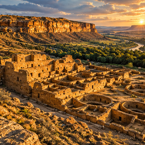
Chaco is an engineering wonder measured not only in stone, but in relationships. Between about AD 850 and 1250, ancestral Pueblo communities developed a regional center in northwestern New Mexico whose great houses, roads, ceremonial spaces, water-control works and astronomical markers reveal extensive planning. Pueblo Bonito alone grew to more than 600 rooms and dozens of kivas. The most intriguing evidence is the way architecture and landscape interact with sunlight, cardinal direction, lunar cycles and the movement of sound.
A landscape-scale engineering center. Chaco combined monumental masonry, planned geometry, ceremonial architecture, roads and astronomical observation within a demanding high-desert environment.
LocationNorthwestern New Mexico
Major Chaco eraAbout AD 850–1250
Pueblo Bonito600+ rooms
Great-house heightUp to 4–5 stories
Regional roadsHundreds of miles
Engineering focusLight · Sound · Precision
Three Ways to Read Chaco
Light, Sound & Precision
The three subjects below are deliberately separated. A measured light event is not automatically proof of astronomical intent. An acoustic effect is not automatically proof of an engineered sound machine. A precise orientation can be measured even when its cultural meaning remains under study. The exhibit therefore distinguishes physical observation from interpretation.
Light
The Sun Dagger
High on Fajada Butte, three sandstone slabs stand before two spiral petroglyphs. Seasonal sunlight once produced distinctive light and shadow patterns across the spirals around solstices and equinoxes. The slabs are stone, the spirals are human-made, and the observed relationship between them became one of the best-known archaeoastronomical features in the Southwest.
The slabs have shifted, so the historic light pattern no longer crosses the spiral exactly as it did when documented in the twentieth century.
Observed phenomenon + human marking
Sound
The Chaco Soundscape
Great kivas, plazas and the canyon itself created spaces in which voices and instruments could be heard by groups. Modern archaeoacoustic research has modeled sound propagation across central Chaco, including speech and conch-shell trumpet scenarios near Pueblo Bonito.
The modeling demonstrates that sound belongs in the engineering discussion, but it does not prove that every kiva or great house was deliberately shaped as an acoustic device.
Measured/modelled acoustics · intent under continued study
Precision
Architecture & Sky
Chacoan great houses were planned rather than simply accumulated room by room. The National Park Service notes solar, lunar and cardinal orientations among Chacoan structures, together with calendrical markings documenting celestial events.
The geometry is measurable. Individual accounts about why a particular wall, doorway or inter-site line was oriented as it was must still be evaluated separately.
Measured geometry · interpretations vary
Phenomenon
What can be observed or measured
Human contribution
Museum assessment
Fajada Butte light marker
Seasonal light and shadow interact with spiral petroglyphs.
The spirals were carved by people; the sandstone setting supplied the light path.
Strong evidence of deliberate observation and marking.
Chaco soundscape
Sound propagation can be modeled across plazas, great houses and nearby landscape.
Architecture, mounds and ceremonial spaces altered how people occupied the soundscape.
Acoustic behavior is real; degree of intentional acoustic design remains interpretive.
Architectural orientation
Building axes, wall lines and relationships to cardinal and celestial directions can be surveyed.
Major structures were deliberately planned and positioned.
Planning is established; each astronomical interpretation requires individual evidence.
Why Chaco Belongs in an Engineering Collection
Chaco's achievement was systemic. Builders organized multistory masonry, timber, roads, water management, formal plazas and ceremonial spaces across a harsh landscape. The engineering question is therefore larger than how a wall was raised. It asks how surveying, seasonal observation, communication, ceremony and landscape planning were coordinated over generations. That combination makes Chaco a useful counterpoint to Giza and Baalbek: the marvel is not a single enormous stone, but a network of precisely planned relationships.
Beyond Chaco
A Wider Southwestern Tradition of Sky Watching
The relationship between sunlight, landscape and human marking was not confined to Chaco Canyon. Other Southwestern sites preserve striking examples, ranging from a sunlight shaft touching a spiral to a lunar rise framed by natural pinnacles. Here the distinction between nature and human action becomes especially important.
Arizona · Sunlight
Puerco Pueblo
At Puerco Pueblo in Petrified Forest National Park, a small spiral petroglyph interacts with sunlight for roughly two weeks around the summer solstice. A shaft of light moves down the boulder as the Sun rises and reaches the center of the spiral around the seasonal turning point.
The sunlight is natural. The spiral is human-made. Their placement together is the archaeological story.
Documented solar marker
Utah · Sunlight
Hovenweep, Holly Unit
At the Holly Unit, two naturally positioned boulders form a narrow opening. Around the summer solstice, beams of sunlight enter that opening and bisect spiral and concentric-circle petroglyphs before the panel becomes fully illuminated.
This is an unusually clear natural-and-human combination: nature supplied the aperture, people supplied the marks placed where the seasonal light could interact with them.
Natural aperture + human petroglyphs
Colorado · Moon
Chimney Rock
At Chimney Rock, the Moon can rise between the dramatic sandstone pinnacles during the northern major lunar standstill, part of an approximately 18.6-year lunar cycle. The Great House Pueblo provides a particularly important viewing context.
The pinnacles are entirely natural. The archaeological question is whether Chacoan builders intentionally selected and developed the architectural setting in relation to this rare lunar event.
Phenomenon established · intent interpreted
Site
Natural phenomenon
Human action
Evidence assessment
Puerco Pueblo
Seasonal shaft of sunlight crosses the boulder.
A spiral petroglyph occupies the point of interaction.
Strongly documented solar-marker relationship.
Hovenweep, Holly Unit
Natural boulders create the opening for solstice light.
Spiral and concentric petroglyphs were placed on the illuminated panel.
NPS interprets the panel as a summer-solstice marker.
Chimney Rock
At major lunar standstill, moonrise can appear between the pinnacles.
Chacoan architecture occupies a viewing landscape associated with the phenomenon.
Lunar event is measurable; intentional architectural relationship remains an archaeological interpretation.
The Pattern
Across these sites, the builders did not need to manufacture the Sun, Moon, rock openings or horizon. The engineering achievement could instead lie in observation, placement and repeatability: recognizing a recurring event, marking it, orienting architecture toward it, or preserving a viewing position from which it could be observed again. That is a subtler form of engineering than moving an 800-ton block, but it requires long-term attention to geometry, season and landscape.
areas for further study
Was sound deliberately engineered? Acoustic behavior and modeled audibility are measurable. The extent to which builders deliberately shaped architecture or landscape for sound remains under study.
How was astronomical knowledge maintained? Repeated seasonal and lunar observations imply knowledge transmission, but the exact procedures, specialists and teaching traditions are not preserved in written construction manuals.
Why do similar light markers occur across the Southwest? They demonstrate recurring attention to seasonal cycles, but similarity alone does not prove a single centralized design system.
Research Sources
National Park Service, Chaco Culture National Historical Park: Pueblo Period, Pueblo Bonito, Fajada Butte and park history resources.
National Park Service, Archeoastronomy in Stone, including the Fajada Butte and Puerco Pueblo solar markers.
National Park Service, Hovenweep National Monument, Holly Petroglyph Panel and Holly Group interpretation.
Witt, David E. and Kristy E. Primeau, Performance Space, Political Theater, and Audibility in Downtown Chaco, Acoustics 1(1), 2019.
U.S. Forest Service, San Juan National Forest, Chimney Rock National Monument resources on the major lunar standstill.